Geography & Exploration
The rapid expansion of territory under Muslim rule fell in line with Qur’anic recommendations to encourage travel in search of knowledge and other benefits. Muslims frequently traveled long journeys such as Hajj, a religious visit to Mecca, and it created the need for mapping. Muhammad al-Idrisi who made one of the first accurate maps in the world that include the Americas as Muslims had traveled to the Americas earlier than Christopher Columbus.
“Have they not traveled in the land, and have they hearts wherewith to feel and ears wherewith to hear?”
(Qur’an 22:46).
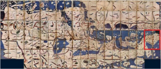
Map of Al-Idrisi (Copy of 1300 AD; approx.). National Library of France (Courtesy of BlogDruta)
|
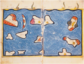
This 12th-century map of the Indian Ocean by al-Idrisi is so obviously imprecise as to seem almost decorative. (Courtesy of Aramco World)
|
“For three centuries, geographers used al-Idrisi’s unaltered maps. His works inspired some of the world’s greatest explorers, scholars and cartographers including Ibn Battuta, Ibn Khaldun, Piri Re’is, Christopher Columbus and Vasco da Gama.”
(Courtesy to The Planisphere)
(Courtesy to The Planisphere)
